News Categories
News Archive
- Jul 2017 [ 1 ]
- Oct 2015 [ 1 ]
- Aug 2015 [ 6 ]
- Jul 2015 [ 5 ]
- Mar 2015 [ 1 ]
- Sep 2014 [ 7 ]
- Jun 2014 [ 5 ]
- Apr 2014 [ 2 ]
- Jul 2013 [ 7 ]
- Jun 2013 [ 8 ]
- Apr 2013 [ 2 ]
- Mar 2013 [ 1 ]
- Nov 2012 [ 2 ]
- Oct 2012 [ 1 ]
- Sep 2012 [ 3 ]
- Oct 2014 [ 1 ]
- Oct 2013 [ 1 ]
- Jul 2021 [ 1 ]
- Aug 2016 [ 4 ]
- Jul 2016 [ 3 ]
- Jun 2016 [ 4 ]
- Jun 2015 [ 2 ]
- May 2015 [ 1 ]
- Aug 2014 [ 9 ]
- Jul 2014 [ 11 ]
- Sep 2013 [ 1 ]
- Aug 2013 [ 9 ]
- Aug 2012 [ 14 ]
- Jul 2012 [ 13 ]
- Jun 2012 [ 3 ]
- May 2012 [ 2 ]
News
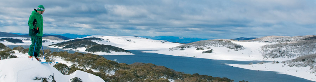
Light snow developing today and continuing on Thursday. Further light snow likely on Sunday.
Summary:
Strong high pressure will continue to limit snow-bearing systems for the next week.
There is a mass of cloud over much of Victoria and southern NSW, but most alpine resorts have woken to sunshine. This will gradually turn to cloud today, as the next cold front crosses the Bight. Once the cloud arrives, the airmass changes - so the dew point temperature will rapidly rise (a sign of moisture increasing), and the air temperature will fall (the heat from the sun stops). This means that what does fall later today and on Thursday will be snow above about 1500 metres. The front will only clip the southeast of the country, so it is light snow that will bring up to 5cm, Wednesday night and Thursday.
Another cold front should be able to clip the southeast of the country on Saturday night/Sunday. We can expect further light snow on Sunday, and as the high is not in such a strong belt by this stage, we may see 5 to 10 cm. This system will be colder than the Wednesday/Thursday system.
Outlook:
We are underneath an upper level cold pool for some of next week. The surface shows high pressure centreed to our west - but beware the upper cold pool! - it always creates some precipitation as it brings energy and instability. There may be a few days of light snow just because that is over us.
Commentary above courtesy of Jane's Weather. www.janesweather.com